 Catalogue PIGMA
ESRI Shapefile
Type of resources
Available actions
Topics
Keywords
Contact for the resource
Provided by
Years
Formats
Representation types
Update frequencies
status
Scale
Resolution
-
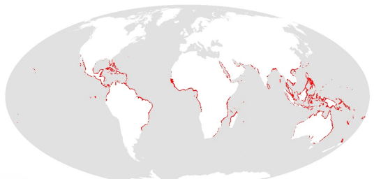
This dataset shows the global distribution of mangroves, and was produced as joint initiatives of the International Tropical Timber Organization (ITTO), International Society for Mangrove Ecosystems (ISME), Food and Agriculture Organization of the United Nations (FAO), UN Environment World Conservation Monitoring Centre (UNEP-WCMC), United Nations Educational, Scientific and Cultural Organization’s Man and the Biosphere Programme (UNESCO-MAB), United Nations University Institute for Water, Environment and Health (UNU-INWEH) and The Nature Conservancy (TNC). Major funding was provided by ITTO through a Japanese Government project grant; the project was implemented by ISME.
-

-

-
-
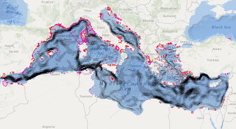
In order to assess the connectivity oceanographic data will be used. A shape map will be created combining data on MPAs adequacy and distribution of MPAs and temperature, currents seasonal GIS layers (The temperature and currents are INGV climatological products made available to CH2.
-
-

This dataset shows the global distribution of seagrasses, and is composed of two subsets of point and polygon occurrence data. The data were compiled by UN Environment World Conservation Monitoring Centre in collaboration with many collaborators (e.g. Frederick Short of the University of New Hampshire), organisations (e.g. OSPAR), and projects (e.g. the European project Mediterranean Sensitive Habitats “Mediseh”), across the globe (full list available in accompanying metadata table within the dataset).
-
Calculation of the average annual sediment balance per stretch of coast for the past 10 years.
-

-